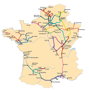
Navigable Waterways
The Somme canal – The North Canal - The wide canal (from Arleux to Estrun) – The narrow Escaut - The Saint-Quentin canal - The canal alongside the Oise and the Oise - The channelled Sambre and the canal from the Sambre to the Oise - The canal alongside the Aisne and the channelled Aisne - The canal from the Oise to the Aisne.
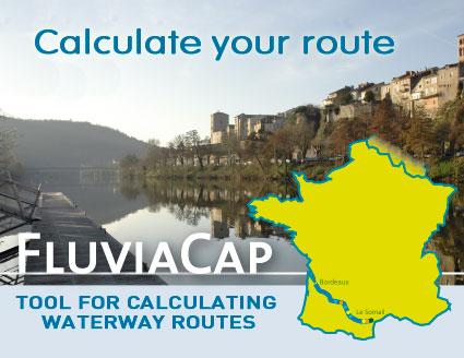
Display the route
 Picardie is THE hub of the French river network. Six fine waterways form a star structure around Compiègne, Péronne and Saint-Quentin. Picardie is THE hub of the French river network. Six fine waterways form a star structure around Compiègne, Péronne and Saint-Quentin.
The great connection between drainage basins and an obligatory passage between Paris and the North, the Oise collects most traffic in this vast network. In the North it is taken over by two parallel canals: the North Canal, which is mainly commercial and the Saint-Quentin Canal, which is more touristic.
From 2017, its traffic should be considerably increased by the completion of a broad canal between Compiègne and Belgium: the future Seine-North-Europe canal.
To the East, the Aisne and its lateral canal connect Picardie to the Champagne region and to the Ardennes.
 A little higher, in the north-east direction, the canal from the Sambre to the Oise has long been the most pleasant transit route between France and Belgium. A pretty waterway which, unfortunately has been interrupted in the middle, for six years, by the risk of collapse concerning the two canal bridges of Vadencourt and Macquigny. A little higher, in the north-east direction, the canal from the Sambre to the Oise has long been the most pleasant transit route between France and Belgium. A pretty waterway which, unfortunately has been interrupted in the middle, for six years, by the risk of collapse concerning the two canal bridges of Vadencourt and Macquigny.
To the west, lastly, the channelled Somme wanders around in a superb aquatic environment, alternating ponds and marshes, as far as the famous market gardens at Amiens, before reaching the magnificent estuary of the Bay of the Somme.
NOTE: 156 pages at a scale of 1/50,000 and at 1/25,000 for the route of the Oise.
We navigate from Saint-Valery-sur-Somme to Conflans-Sainte-Honorine and, we hope, again from Jeumont to Berry-au-Bac… Picardie, a region that is rich in waterways, has two canals that are closed to navigation: that of the upstream Somme and that from the Sambre to the Oise.
|